
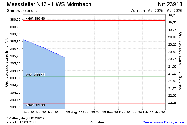
Current data N13 - HWS Mörnbach
Groundwater level [m above sealevel]: 385.20
Distance to surface [m]: 20.74
Last value from 02.03.2026 18:00
Ground level [m above sealevel]: 405.94
| Date | Groundwater level [m above sealevel] |
|---|---|
| 02.03.2026 | 384.11 |
| 01.03.2026 | 384.13 |
| 28.02.2026 | 384.15 |
| 27.02.2026 | 384.17 |
| 26.02.2026 | 384.18 |
| 25.02.2026 | 384.17 |
| 24.02.2026 | 384.16 |
| 23.02.2026 | 384.14 |