
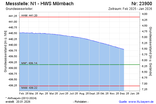
Current data N1 - HWS Mörnbach
Groundwater level [m above sealevel]: 439.49
Distance to surface [m]: 5.82
Last value from 11.03.2026 13:00
Ground level [m above sealevel]: 445.31
| Date | Groundwater level [m above sealevel] |
|---|---|
| 11.03.2026 | 439.49 |
| 10.03.2026 | 439.49 |
| 09.03.2026 | 439.49 |
| 08.03.2026 | 439.50 |
| 07.03.2026 | 439.50 |
| 06.03.2026 | 439.51 |
| 05.03.2026 | 439.51 |
| 04.03.2026 | 439.52 |