
- Start >
- Groundwater >
- Waterlevel of upper layer >
- Bayern >
- N.OESTL. KAHL A. MAIN 3 >
- Chart of total period

Chart of total period N.OESTL. KAHL A. MAIN 3
Groundwater levels of the total period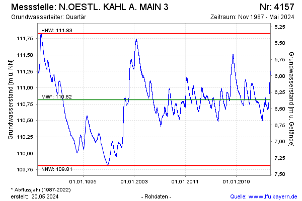
Groundwater level [m above sealevel]: 111.21
Distance to surface [m]: 5.97
Last value from 28.04.2024 10:00
Ground level [m above sealevel]: 117.18
| Date | Groundwater level [m above sealevel] |
|---|---|
| 28.04.2024 | 111.21 |
| 27.04.2024 | 111.21 |
| 26.04.2024 | 111.21 |
| 25.04.2024 | 111.21 |
| 24.04.2024 | 111.20 |
| 23.04.2024 | 111.20 |
| 22.04.2024 | 111.19 |
| 21.04.2024 | 111.19 |
© Bayerisches Landesamt für Umwelt 2024