
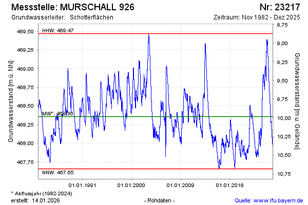
Chart of total period MURSCHALL 926
Groundwater level [m above sealevel]: 467,61
Distance to surface [m]: 10,73
Last value from 08.07.2026 09:12
Ground level [m above sealevel]: 478.34
| Date | Groundwater level [m above sealevel] |
|---|---|
| 08.07.2026 | 467.61 |
| 07.07.2026 | 467.62 |
| 06.07.2026 | 467.62 |
| 05.07.2026 | 467.62 |
| 04.07.2026 | 467.62 |
| 03.07.2026 | 467.62 |
| 02.07.2026 | 467.63 |
| 01.07.2026 | 467.63 |