
- Start >
- Groundwater >
- Waterlevel of upper layer >
- Bayern >
- München KP 16 >
- Chart of total period

Chart of total period München KP 16
Groundwater levels of the total period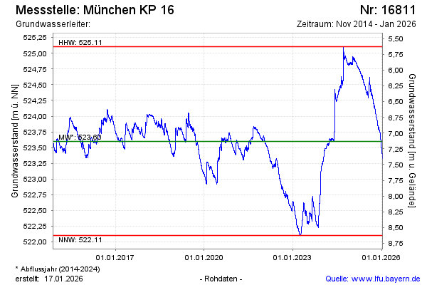
Groundwater level [m above sealevel]: 523.17
Distance to surface [m]: 7.56
Last value from 11.03.2026 09:00
Ground level [m above sealevel]: 530.73
| Date | Groundwater level [m above sealevel] |
|---|---|
| 10.03.2026 | 523.19 |
| 09.03.2026 | 523.20 |
| 08.03.2026 | 523.21 |
| 07.03.2026 | 523.23 |
| 06.03.2026 | 523.24 |
| 05.03.2026 | 523.25 |
| 04.03.2026 | 523.25 |
| 03.03.2026 | 523.26 |
© Bayerisches Landesamt für Umwelt 2026