
- Start >
- Groundwater >
- Waterlevel of upper layer >
- Bayern >
- MOOS_OP17 >
- Chart of total period

Chart of total period MOOS_OP17
Groundwater levels of the total period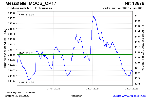
Groundwater level [m above sealevel]: 315.36
Distance to surface [m]: 11.49
Last value from 02.05.2024 08:00
Ground level [m above sealevel]: 326.85
| Date | Groundwater level [m above sealevel] |
|---|---|
| 02.05.2024 | 315.36 |
| 01.05.2024 | 315.36 |
| 30.04.2024 | 315.36 |
| 29.04.2024 | 315.36 |
| 28.04.2024 | 315.37 |
| 27.04.2024 | 315.38 |
| 26.04.2024 | 315.38 |
| 25.04.2024 | 315.39 |
© Bayerisches Landesamt für Umwelt 2024