
- Start >
- Groundwater >
- Waterlevel of upper layer >
- Bayern >
- MOOS 114A >
- Chart of total period

Chart of total period MOOS 114A
Groundwater levels of the total period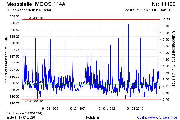
Groundwater level [m above sealevel]: 386.91
Distance to surface [m]: 1.73
Last value from 06.03.2026 09:00
Ground level [m above sealevel]: 388.64
| Date | Groundwater level [m above sealevel] |
|---|---|
| 06.03.2026 | 386.91 |
| 05.03.2026 | 386.92 |
| 04.03.2026 | 386.94 |
| 03.03.2026 | 386.96 |
| 02.03.2026 | 386.98 |
| 01.03.2026 | 386.99 |
| 28.02.2026 | 387.00 |
| 27.02.2026 | 386.99 |
© Bayerisches Landesamt für Umwelt 2026