
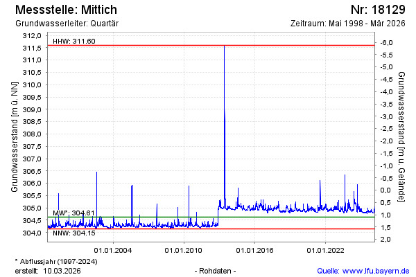
Chart of total period Mittich
note
GW Messtelle im Grundnetz
Groundwater level [m above sealevel]: 304,78
Distance to surface [m]: 0,94
Last value from 23.07.2026 00:08
Ground level [m above sealevel]: 305.72
| Date | Groundwater level [m above sealevel] |
|---|---|
| 22.07.2026 | 304.78 |
| 21.07.2026 | 304.78 |
| 20.07.2026 | 304.79 |
| 19.07.2026 | 304.79 |
| 18.07.2026 | 304.77 |
| 17.07.2026 | 304.77 |
| 16.07.2026 | 304.76 |
| 15.07.2026 | 304.77 |