
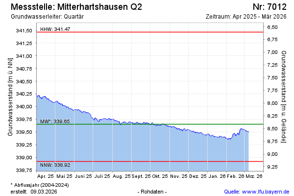
Current data Mitterhartshausen Q2
Groundwater level [m above sealevel]: 339.08
Distance to surface [m]: 8.99
Last value from 15.07.2026 08:00
Ground level [m above sealevel]: 348.07
| Date | Groundwater level [m above sealevel] |
|---|---|
| 15.07.2026 | 339.08 |
| 14.07.2026 | 339.06 |
| 13.07.2026 | 339.07 |
| 12.07.2026 | 339.08 |
| 11.07.2026 | 339.09 |
| 10.07.2026 | 339.11 |
| 09.07.2026 | 339.13 |
| 08.07.2026 | 339.18 |