
- Start >
- Groundwater >
- Waterlevel of upper layer >
- Bayern >
- MITTENWALD-GERBER 801 >
- Chart of total period

Chart of total period MITTENWALD-GERBER 801
Groundwater levels of the total period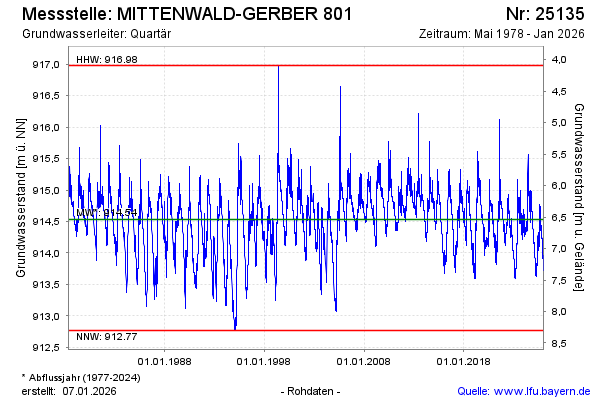
Groundwater level [m above sealevel]: 914.47
Distance to surface [m]: 6.60
Last value from 20.05.2024 01:00
Ground level [m above sealevel]: 921.07
| Date | Groundwater level [m above sealevel] |
|---|---|
| 19.05.2024 | 914.48 |
| 18.05.2024 | 914.48 |
| 17.05.2024 | 914.50 |
| 16.05.2024 | 914.48 |
| 15.05.2024 | 914.49 |
| 14.05.2024 | 914.49 |
| 13.05.2024 | 914.50 |
| 12.05.2024 | 914.48 |
© Bayerisches Landesamt für Umwelt 2024