
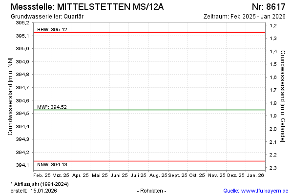
Current data MITTELSTETTEN MS/12A
Groundwater level [m above sealevel]: 394.40
Distance to surface [m]: 1.98
Last value from 18.11.2025 13:45
Ground level [m above sealevel]: 396.38
| Date | Groundwater level [m above sealevel] |
|---|---|
| 31.10.2024 | 394.50 |
| 06.03.2024 | 394.72 |
| 04.04.2023 | 394.44 |
| 07.07.2022 | 394.41 |
| 03.03.2021 | 394.68 |
| 20.02.2020 | 394.51 |
| 24.01.2019 | 394.73 |
| 22.01.2018 | 394.92 |