
- Start >
- Groundwater >
- Waterlevel of upper layer >
- Bayern >
- MINDELHEIM GN B1 >
- Chart of total period

Chart of total period MINDELHEIM GN B1
Groundwater levels of the total period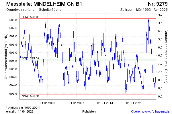
Groundwater level [m above sealevel]: 594.53
Distance to surface [m]: 7.80
Last value from 10.03.2026 04:00
Ground level [m above sealevel]: 602.33
| Date | Groundwater level [m above sealevel] |
|---|---|
| 09.03.2026 | 594.52 |
| 08.03.2026 | 594.52 |
| 07.03.2026 | 594.52 |
| 06.03.2026 | 594.52 |
| 05.03.2026 | 594.51 |
| 04.03.2026 | 594.50 |
| 03.03.2026 | 594.49 |
| 02.03.2026 | 594.47 |
© Bayerisches Landesamt für Umwelt 2026