
- Start >
- Groundwater >
- Waterlevel of upper layer >
- Bayern >
- Mertseebecken 3 >
- Chart of total period

Chart of total period Mertseebecken 3
Groundwater levels of the total period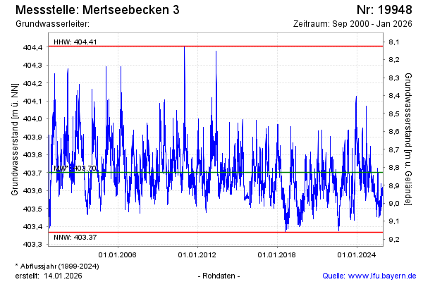
note
GW Messstelle im SN HRB Mertsee EG
Groundwater level [m above sealevel]: 403.55
Distance to surface [m]: 8.98
Last value from 27.02.2026 00:00
Ground level [m above sealevel]: 412.53
| Date | Groundwater level [m above sealevel] |
|---|---|
| 26.02.2026 | 403.85 |
| 25.02.2026 | 403.86 |
| 24.02.2026 | 403.86 |
| 23.02.2026 | 403.87 |
| 22.02.2026 | 403.81 |
| 21.02.2026 | 403.74 |
| 20.02.2026 | 403.71 |
| 19.02.2026 | 403.81 |
© Bayerisches Landesamt für Umwelt 2026