
- Start >
- Groundwater >
- Waterlevel of upper layer >
- Bayern >
- MERTINGEN BHF 61 >
- Chart of total period

Chart of total period MERTINGEN BHF 61
Groundwater levels of the total period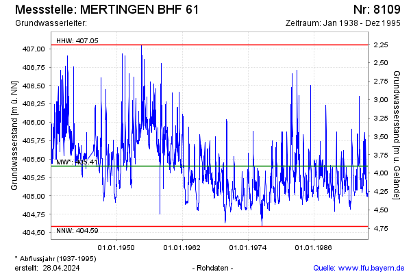
Groundwater level [m above sealevel]: 405.05
Distance to surface [m]: 4.26
Last value from 25.12.1995 12:00
Ground level [m above sealevel]: 409.31
| Date | Groundwater level [m above sealevel] |
|---|---|
| 18.12.1995 | 405.01 |
| 11.12.1995 | 405.02 |
| 04.12.1995 | 405.06 |
| 27.11.1995 | 405.09 |
| 20.11.1995 | 404.98 |
| 13.11.1995 | 404.99 |
| 06.11.1995 | 405.02 |
| 30.10.1995 | 405.02 |
© Bayerisches Landesamt für Umwelt 2026