
- Start >
- Groundwater >
- Waterlevel of upper layer >
- Bayern >
- Merkendorf-Hirschlach >
- Current data

Current data Merkendorf-Hirschlach
Groundwater levels of the last 12 months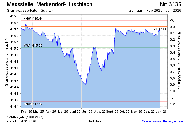
Groundwater level [m above sealevel]: 415.34
Distance to surface [m]: 0.00
Last value from 06.03.2026 07:00
Ground level [m above sealevel]: 415.34
| Date | Groundwater level [m above sealevel] |
|---|---|
| 05.03.2026 | 415.36 |
| 04.03.2026 | 415.37 |
| 03.03.2026 | 415.38 |
| 02.03.2026 | 415.39 |
| 01.03.2026 | 415.39 |
| 28.02.2026 | 415.40 |
| 27.02.2026 | 415.41 |
| 26.02.2026 | 415.42 |
© Bayerisches Landesamt für Umwelt 2026