
- Start >
- Groundwater >
- Waterlevel of upper layer >
- Bayern >
- MARKT GROENENBACH >
- Current data

Current data MARKT GROENENBACH
Groundwater levels of the last 12 months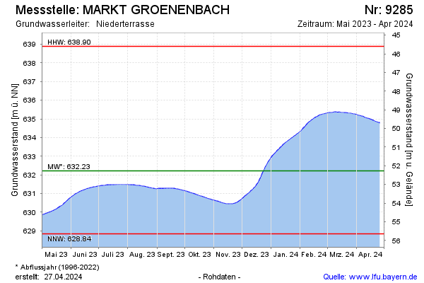
Groundwater level [m above sealevel]: 629.41
Distance to surface [m]: 55.08
Last value from 02.03.2026 08:27
Ground level [m above sealevel]: 684.49
| Date | Groundwater level [m above sealevel] |
|---|---|
| 23.02.2026 | 629.37 |
| 02.02.2026 | 629.41 |
| 01.02.2026 | 629.41 |
| 31.01.2026 | 629.42 |
| 30.01.2026 | 629.42 |
| 29.01.2026 | 629.42 |
| 28.01.2026 | 629.42 |
| 27.01.2026 | 629.43 |
© Bayerisches Landesamt für Umwelt 2026