
- Start >
- Groundwater >
- Waterlevel of upper layer >
- Bayern >
- MARKFELD R 26 >
- Chart of total period

Chart of total period MARKFELD R 26
Groundwater levels of the total period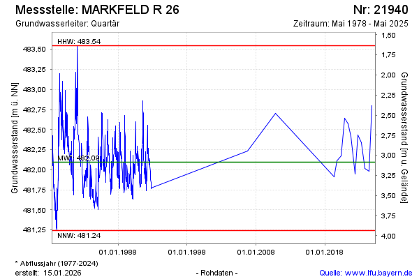
note
Die Messstelle wird nicht mehr beobachtet.
Groundwater level [m above sealevel]: 482.33
Distance to surface [m]: 2.85
Last value from 13.05.2025 10:00
Ground level [m above sealevel]: 485.18
| Date | Groundwater level [m above sealevel] |
|---|---|
| 14.10.2024 | 482.80 |
| 13.05.2024 | 481.98 |
| 11.10.2023 | 482.02 |
| 02.05.2023 | 482.34 |
| 10.10.2022 | 482.43 |
| 04.05.2022 | 481.95 |
| 07.10.2021 | 482.42 |
| 11.05.2021 | 482.57 |
© Bayerisches Landesamt für Umwelt 2026