
- Start >
- Groundwater >
- Waterlevel of upper layer >
- Bayern >
- LUNGSDORF/WIESE 141 >
- Chart of total period

Chart of total period LUNGSDORF/WIESE 141
Groundwater levels of the total period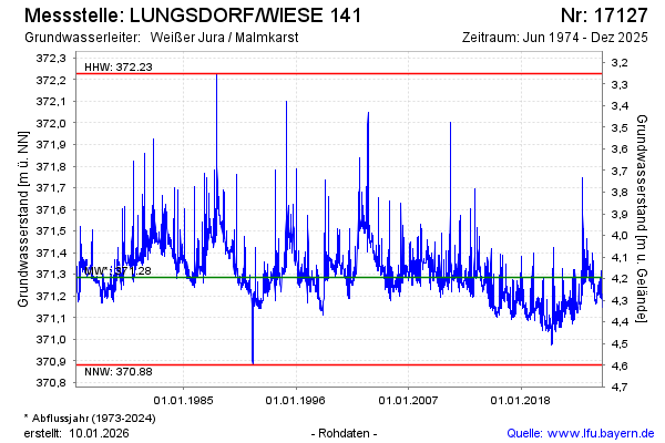
Groundwater level [m above sealevel]: 371.16
Distance to surface [m]: 4.32
Last value from 19.03.2026 14:30
Ground level [m above sealevel]: 375.48
| Date | Groundwater level [m above sealevel] |
|---|---|
| 19.03.2026 | 371.15 |
| 18.03.2026 | 371.16 |
| 17.03.2026 | 371.16 |
| 16.03.2026 | 371.16 |
| 15.03.2026 | 371.16 |
| 14.03.2026 | 371.17 |
| 13.03.2026 | 371.17 |
| 12.03.2026 | 371.17 |
© Bayerisches Landesamt für Umwelt 2026