
- Start >
- Groundwater >
- Waterlevel of upper layer >
- Bayern >
- Ludwigsfeld süd, Illerkanal >
- Chart of total period

Chart of total period Ludwigsfeld süd, Illerkanal
Groundwater levels of the total period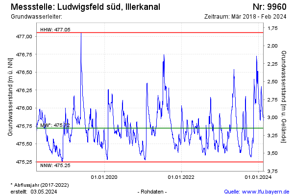
Groundwater level [m above sealevel]: 475.71
Distance to surface [m]: 3.16
Last value from 06.11.2025 10:09
Ground level [m above sealevel]: 478.87
| Date | Groundwater level [m above sealevel] |
|---|---|
| 06.11.2025 | 475.71 |
| 05.11.2025 | 475.72 |
| 04.11.2025 | 475.70 |
| 03.11.2025 | 475.68 |
| 02.11.2025 | 475.69 |
| 01.11.2025 | 475.69 |
| 31.10.2025 | 475.69 |
| 30.10.2025 | 475.67 |
© Bayerisches Landesamt für Umwelt 2025