
- Start >
- Groundwater >
- Waterlevel of upper layer >
- Bayern >
- LOHHOF 275A >
- Chart of total period

Chart of total period LOHHOF 275A
Groundwater levels of the total period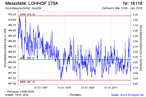
Groundwater level [m above sealevel]: 468.26
Distance to surface [m]: 3.23
Last value from 23.05.2024 09:00
Ground level [m above sealevel]: 471.49
| Date | Groundwater level [m above sealevel] |
|---|---|
| 23.05.2024 | 468.26 |
| 22.05.2024 | 468.25 |
| 21.05.2024 | 468.24 |
| 20.05.2024 | 468.25 |
| 19.05.2024 | 468.26 |
| 18.05.2024 | 468.24 |
| 17.05.2024 | 468.25 |
| 16.05.2024 | 468.25 |
© Bayerisches Landesamt für Umwelt 2024