
- Start >
- Groundwater >
- Waterlevel of upper layer >
- Bayern >
- LOEPSINGEN 7C/A >
- Chart of total period

Chart of total period LOEPSINGEN 7C/A
Groundwater levels of the total period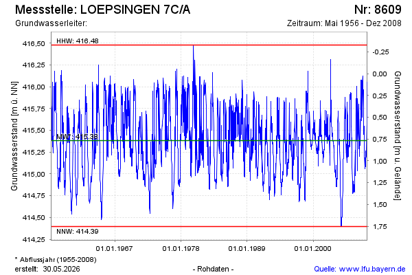
Groundwater level [m above sealevel]: 416.02
Distance to surface [m]: 0.13
Last value from 29.12.2008 10:00
Ground level [m above sealevel]: 416.15
| Date | Groundwater level [m above sealevel] |
|---|---|
| 22.12.2008 | 416.05 |
| 15.12.2008 | 415.72 |
| 08.12.2008 | 415.62 |
| 01.12.2008 | 415.53 |
| 24.11.2008 | 415.58 |
| 17.11.2008 | 415.29 |
| 10.11.2008 | 415.28 |
| 03.11.2008 | 415.24 |
© Bayerisches Landesamt für Umwelt 2026