Year chart of precipitation LERCHENFELD Q4
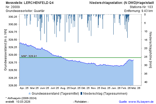
Groundwater level [m above sealevel]: 328,51
Distance to surface [m]: 3,66
Last value from 14.07.2026 10:00
Ground level [m above sealevel]: 332.17

Groundwater level [m above sealevel]: 328,51
Distance to surface [m]: 3,66
Last value from 14.07.2026 10:00
Ground level [m above sealevel]: 332.17