
- Start >
- Groundwater >
- Waterlevel of upper layer >
- Bayern >
- LEIPHEIM 18 A >
- Chart of total period

Chart of total period LEIPHEIM 18 A
Groundwater levels of the total period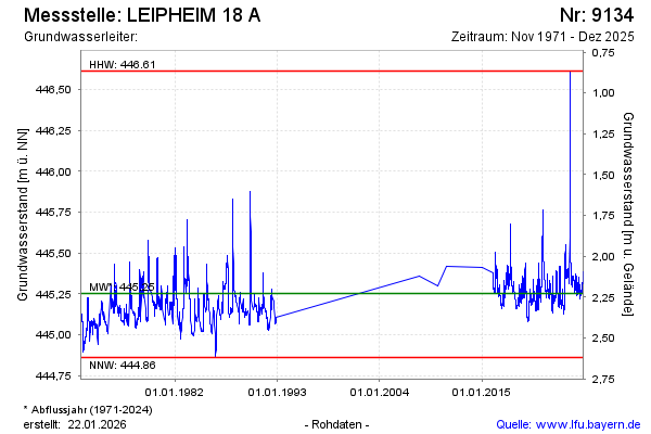
Groundwater level [m above sealevel]: 445.36
Distance to surface [m]: 2.12
Last value from 02.12.2025 15:22
Ground level [m above sealevel]: 447.48
| Date | Groundwater level [m above sealevel] |
|---|---|
| 02.12.2025 | 445.37 |
| 01.12.2025 | 445.37 |
| 30.11.2025 | 445.38 |
| 29.11.2025 | 445.38 |
| 28.11.2025 | 445.38 |
| 27.11.2025 | 445.38 |
| 26.11.2025 | 445.38 |
| 25.11.2025 | 445.37 |
© Bayerisches Landesamt für Umwelt 2026