
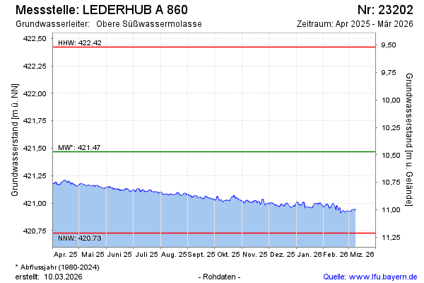
Current data LEDERHUB A 860
Groundwater level [m above sealevel]: 420.97
Distance to surface [m]: 10.97
Last value from 06.05.2026 09:56
Ground level [m above sealevel]: 431.94
| Date | Groundwater level [m above sealevel] |
|---|---|
| 06.05.2026 | 420.96 |
| 05.05.2026 | 420.96 |
| 04.05.2026 | 420.95 |
| 03.05.2026 | 420.95 |
| 02.05.2026 | 420.94 |
| 01.05.2026 | 420.93 |
| 30.04.2026 | 420.92 |
| 29.04.2026 | 420.93 |