
Chart of total period LEBZELTER 13
note
Die Messstelle wird nicht mehr beobachtet.
Groundwater level [m above sealevel]: 421.86
Distance to surface [m]: 7.83
Last value from 10.04.2026 07:46
Ground level [m above sealevel]: 429.69
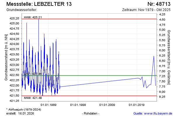
| Date | Groundwater level [m above sealevel] |
|---|---|
| 16.10.2025 | 422.01 |
| 24.04.2025 | 421.98 |
| 10.10.2024 | 423.42 |
| 18.04.2024 | 422.71 |
| 19.10.2023 | 422.03 |
| 20.04.2023 | 422.02 |
| 20.10.2022 | 421.95 |
| 13.04.2022 | 421.86 |