
- Start >
- Groundwater >
- Waterlevel of upper layer >
- Bayern >
- LAUCHDORF 561 >
- Chart of total period

Chart of total period LAUCHDORF 561
Groundwater levels of the total period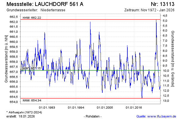
Groundwater level [m above sealevel]: 658.66
Distance to surface [m]: 8.45
Last value from 06.05.2024 08:51
Ground level [m above sealevel]: 667.11
| Date | Groundwater level [m above sealevel] |
|---|---|
| 06.05.2024 | 658.66 |
| 05.05.2024 | 658.67 |
| 04.05.2024 | 658.68 |
| 03.05.2024 | 658.70 |
| 02.05.2024 | 658.72 |
| 01.05.2024 | 658.73 |
| 30.04.2024 | 658.74 |
| 29.04.2024 | 658.75 |
© Bayerisches Landesamt für Umwelt 2024