
Chart of total period LANGWEID 100A
Groundwater level [m above sealevel]: 442,94
Distance to surface [m]: 4,44
Last value from 11.10.2022 10:00
Ground level [m above sealevel]: 447.38
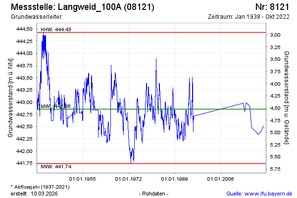
| Date | Groundwater level [m above sealevel] |
|---|---|
| 05.10.2021 | 442.51 |
| 13.10.2020 | 442.40 |
| 26.09.2019 | 442.34 |
| 19.09.2018 | 442.41 |
| 22.05.2017 | 442.47 |
| 06.09.2016 | 442.92 |
| 18.06.2015 | 442.99 |
| 12.11.2014 | 442.80 |