
- Start >
- Groundwater >
- Waterlevel of upper layer >
- Bayern >
- Langendrof 223 >
- Current data

Current data Langendrof 223
Groundwater levels of the last 12 months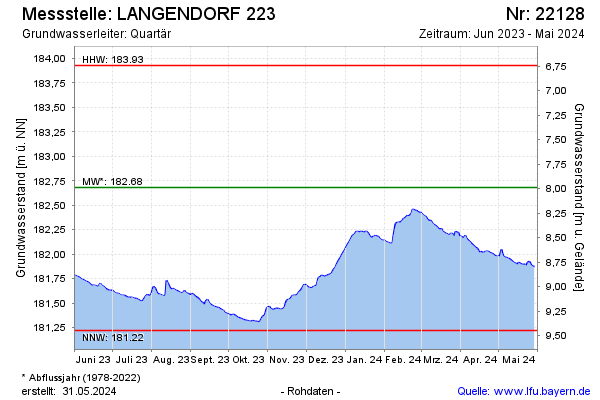
Groundwater level [m above sealevel]: 183.19
Distance to surface [m]: 7.50
Last value from 03.03.2026 10:00
Ground level [m above sealevel]: 190.69
| Date | Groundwater level [m above sealevel] |
|---|---|
| 03.03.2026 | 183.20 |
| 02.03.2026 | 183.20 |
| 01.03.2026 | 183.20 |
| 28.02.2026 | 183.20 |
| 27.02.2026 | 183.20 |
| 26.02.2026 | 183.20 |
| 25.02.2026 | 183.20 |
| 24.02.2026 | 183.18 |
© Bayerisches Landesamt für Umwelt 2026