
Current data LAENGENMUEHLBACH 15.1
Groundwater level [m above sealevel]: 381,87
Distance to surface [m]: 0,79
Last value from 09.04.2026 14:00
Ground level [m above sealevel]: 382.66
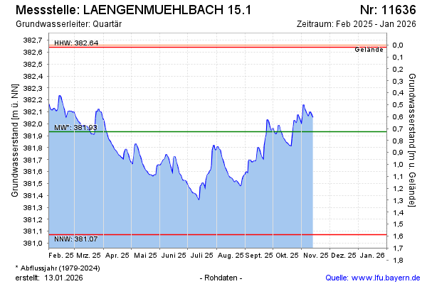
| Date | Groundwater level [m above sealevel] |
|---|---|
| 09.04.2026 | 381.87 |
| 08.04.2026 | 381.88 |
| 07.04.2026 | 381.90 |
| 06.04.2026 | 381.92 |
| 05.04.2026 | 381.95 |
| 04.04.2026 | 381.97 |
| 03.04.2026 | 381.99 |
| 02.04.2026 | 382.01 |