
- Start >
- Groundwater >
- Waterlevel of upper layer >
- Bayern >
- KUTTERLINGERWEG KO 38 >
- Year chart of precipitation

Year chart of precipitation KUTTERLINGERWEG KO 38
Groundwater levels of the last 12 months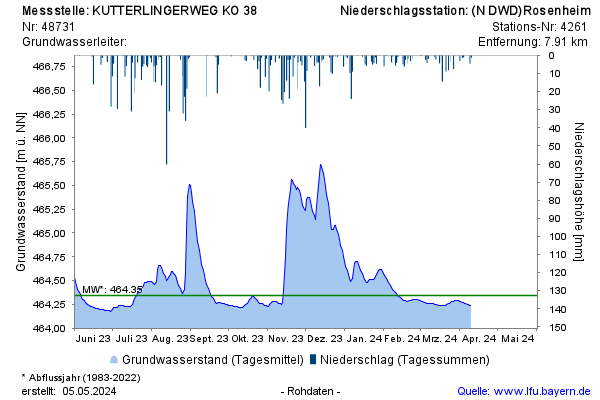
Groundwater level [m above sealevel]: 464,24
Distance to surface [m]: 3,29
Last value from 08.04.2026 09:15
Ground level [m above sealevel]: 467.53
© Bayerisches Landesamt für Umwelt 2026