
- Start >
- Groundwater >
- Waterlevel of upper layer >
- Bayern >
- KREIBG-NW.MAXIM.14 >
- Chart of total period

Chart of total period KREIBG-NW.MAXIM.14
Groundwater levels of the total period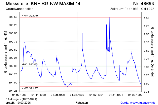
note
Die Messstelle wird nicht mehr beobachtet
Groundwater level [m above sealevel]: 391.45
Distance to surface [m]: 3.52
Last value from 31.10.1992 23:59
Ground level [m above sealevel]: 394.97
| Date | Groundwater level [m above sealevel] |
|---|---|
| 26.10.1992 | 391.42 |
| 17.10.1992 | 391.45 |
| 13.10.1992 | 391.48 |
| 03.10.1992 | 391.53 |
| 01.10.1992 | 391.54 |
| 30.09.1992 | 391.56 |
| 27.09.1992 | 391.56 |
| 25.09.1992 | 391.57 |
© Bayerisches Landesamt für Umwelt 2025