
Chart of total period KOESSNACH N3
note
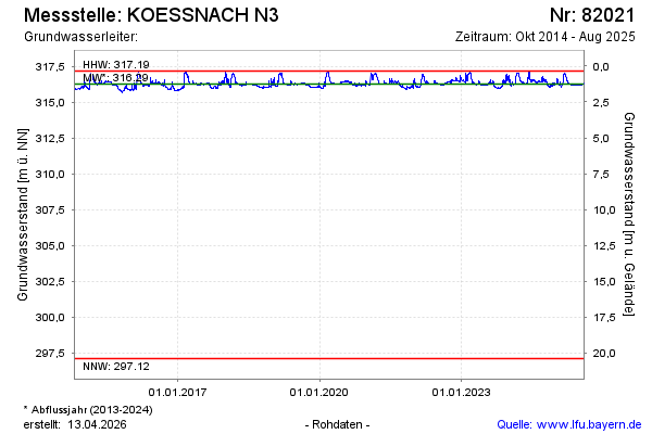
GW Messstelle im SN ?berauer Schleife
Groundwater level [m above sealevel]: 316,20
Distance to surface [m]: 1,31
Last value from 14.04.2026 12:00
Ground level [m above sealevel]: 317.51
| Date | Groundwater level [m above sealevel] |
|---|---|
| 14.04.2026 | 316.20 |
| 13.04.2026 | 316.21 |
| 12.04.2026 | 316.21 |
| 11.04.2026 | 316.22 |
| 10.04.2026 | 316.22 |
| 09.04.2026 | 316.22 |
| 08.04.2026 | 316.22 |
| 07.04.2026 | 316.23 |