
- Start >
- Groundwater >
- Waterlevel of upper layer >
- Bayern >
- KOESCHING D 2 TR >
- Chart of total period

Chart of total period KOESCHING D 2 TR
Groundwater levels of the total period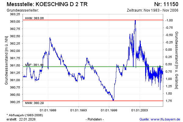
Groundwater level [m above sealevel]: 381.41
Distance to surface [m]: 0.63
Last value from 02.11.2006 08:27
Ground level [m above sealevel]: 382.04
| Date | Groundwater level [m above sealevel] |
|---|---|
| 02.11.2006 | 380.89 |
| 01.11.2006 | 381.19 |
| 31.10.2006 | 381.21 |
| 30.10.2006 | 381.23 |
| 29.10.2006 | 381.23 |
| 28.10.2006 | 381.21 |
| 27.10.2006 | 381.18 |
| 26.10.2006 | 381.20 |
© Bayerisches Landesamt für Umwelt 2026