
- Start >
- Groundwater >
- Waterlevel of upper layer >
- Bayern >
- KOESCHING A.DUERRNH.K3 >
- Chart of total period

Chart of total period KOESCHING A.DUERRNH.K3
Groundwater levels of the total period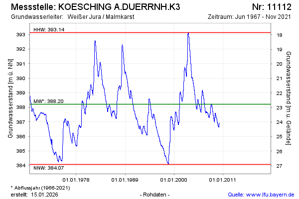
Groundwater level [m above sealevel]: 411.74
Distance to surface [m]: -0.76
Last value from 02.11.2021 15:00
Ground level [m above sealevel]: 410.98
| Date | Groundwater level [m above sealevel] |
|---|---|
| 02.11.2021 | 411.74 |
| 01.11.2021 | 411.74 |
| 31.10.2021 | 411.74 |
| 30.10.2021 | 411.74 |
| 29.10.2021 | 411.74 |
| 28.10.2021 | 411.74 |
| 27.10.2021 | 411.74 |
| 15.03.2010 | 386.92 |
© Bayerisches Landesamt für Umwelt 2026