Year chart of precipitation KLEINOSTHEIM 133
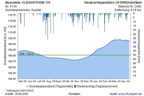
Groundwater level [m above sealevel]: 108,91
Distance to surface [m]: 4,08
Last value from 22.07.2026 10:00
Ground level [m above sealevel]: 112.99

Groundwater level [m above sealevel]: 108,91
Distance to surface [m]: 4,08
Last value from 22.07.2026 10:00
Ground level [m above sealevel]: 112.99