
- Start >
- Groundwater >
- Waterlevel of upper layer >
- Bayern >
- KICKLINGEN 38 >
- Chart of total period

Chart of total period KICKLINGEN 38
Groundwater levels of the total period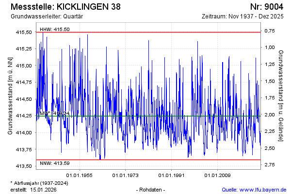
Groundwater level [m above sealevel]: 414.78
Distance to surface [m]: 1.49
Last value from 03.03.2026 10:12
Ground level [m above sealevel]: 416.27
| Date | Groundwater level [m above sealevel] |
|---|---|
| 03.03.2026 | 414.79 |
| 02.03.2026 | 414.81 |
| 01.03.2026 | 414.84 |
| 28.02.2026 | 414.88 |
| 27.02.2026 | 414.92 |
| 26.02.2026 | 414.96 |
| 25.02.2026 | 415.01 |
| 24.02.2026 | 414.96 |
© Bayerisches Landesamt für Umwelt 2026