
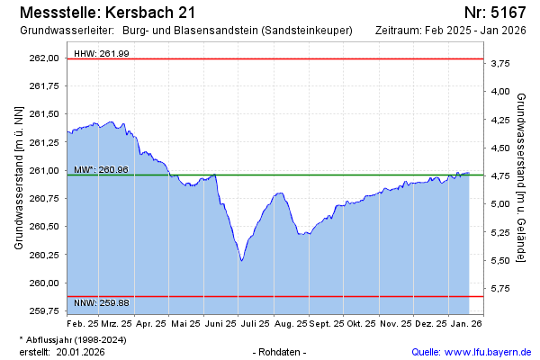
Current data Kersbach 21
Groundwater level [m above sealevel]: 260.73
Distance to surface [m]: 4.97
Last value from 24.06.2026 10:00
Ground level [m above sealevel]: 265.70
| Date | Groundwater level [m above sealevel] |
|---|---|
| 30.06.2026 | 260.56 |
| 29.06.2026 | 260.56 |
| 28.06.2026 | 260.58 |
| 27.06.2026 | 260.61 |
| 26.06.2026 | 260.66 |
| 25.06.2026 | 260.71 |
| 24.06.2026 | 260.74 |
| 23.06.2026 | 260.75 |