
- Start >
- Groundwater >
- Waterlevel of upper layer >
- Bayern >
- KELHEIM GP 8 >
- Chart of total period

Chart of total period KELHEIM GP 8
Groundwater levels of the total period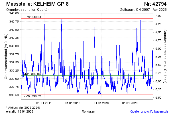
Groundwater level [m above sealevel]: 339.54
Distance to surface [m]: 5.38
Last value from 09.03.2026 10:00
Ground level [m above sealevel]: 344.92
| Date | Groundwater level [m above sealevel] |
|---|---|
| 09.03.2026 | 339.55 |
| 08.03.2026 | 339.57 |
| 07.03.2026 | 339.61 |
| 06.03.2026 | 339.65 |
| 05.03.2026 | 339.69 |
| 04.03.2026 | 339.72 |
| 03.03.2026 | 339.76 |
| 02.03.2026 | 339.80 |
© Bayerisches Landesamt für Umwelt 2026