
- Start >
- Groundwater >
- Waterlevel of upper layer >
- Bayern >
- KATHARINENHOF 32 >
- Chart of total period

Chart of total period KATHARINENHOF 32
Groundwater levels of the total period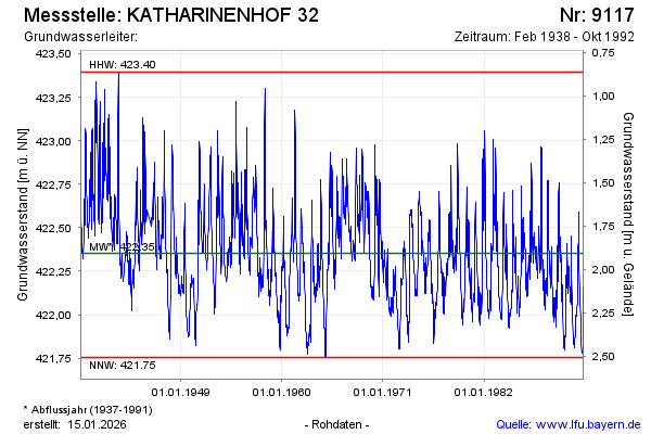
Groundwater level [m above sealevel]: 422.22
Distance to surface [m]: 2.04
Last value from 31.10.1992 16:00
Ground level [m above sealevel]: 424.26
| Date | Groundwater level [m above sealevel] |
|---|---|
| 30.10.1992 | 422.15 |
| 29.10.1992 | 422.07 |
| 28.10.1992 | 422.02 |
| 26.10.1992 | 421.97 |
| 25.10.1992 | 421.94 |
| 21.10.1992 | 421.91 |
| 17.10.1992 | 421.89 |
| 12.10.1992 | 421.87 |
© Bayerisches Landesamt für Umwelt 2026