
- Start >
- Groundwater >
- Waterlevel of upper layer >
- Bayern >
- Kaltenbrunn, Itzgrund >
- Current data

Current data Kaltenbrunn, Itzgrund
Groundwater levels of the last 12 months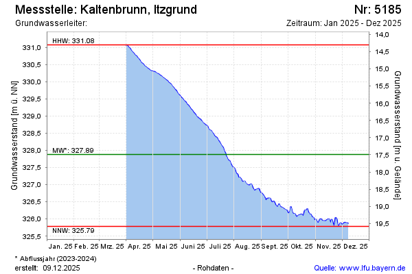
Groundwater level [m above sealevel]: 331.07
Distance to surface [m]: 14.30
Last value from 14.04.2026 06:00
Ground level [m above sealevel]: 345.37
| Date | Groundwater level [m above sealevel] |
|---|---|
| 13.04.2026 | 331.12 |
| 12.04.2026 | 331.14 |
| 11.04.2026 | 331.18 |
| 10.04.2026 | 331.22 |
| 09.04.2026 | 331.26 |
| 08.04.2026 | 331.30 |
| 07.04.2026 | 331.34 |
| 06.04.2026 | 331.38 |
© Bayerisches Landesamt für Umwelt 2026