
- Start >
- Groundwater >
- Waterlevel of upper layer >
- Bayern >
- KALTENBRUNN 214 >
- Chart of total period

Chart of total period KALTENBRUNN 214
Groundwater levels of the total period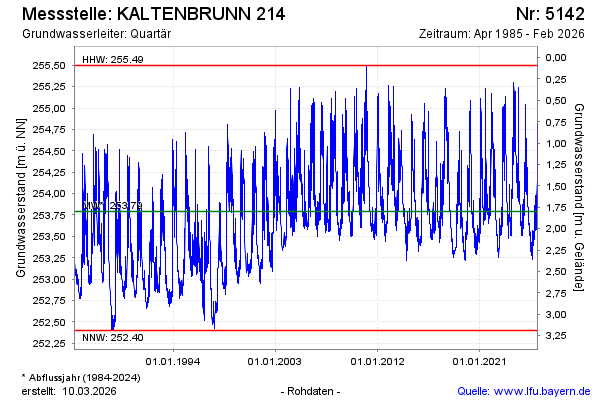
Groundwater level [m above sealevel]: 253.68
Distance to surface [m]: 1.91
Last value from 28.04.2026 07:51
Ground level [m above sealevel]: 255.59
| Date | Groundwater level [m above sealevel] |
|---|---|
| 28.04.2026 | 253.68 |
| 27.04.2026 | 253.69 |
| 26.04.2026 | 253.69 |
| 25.04.2026 | 253.71 |
| 24.04.2026 | 253.72 |
| 23.04.2026 | 253.72 |
| 22.04.2026 | 253.73 |
| 21.04.2026 | 253.75 |
© Bayerisches Landesamt für Umwelt 2026