
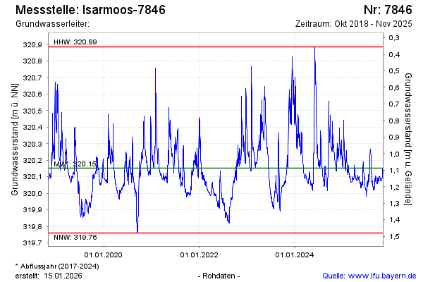
Chart of total period Isarmoos-7846
Groundwater level [m above sealevel]: 320,00
Distance to surface [m]: 1,24
Last value from 26.06.2026 18:15
Ground level [m above sealevel]: 321.24
| Date | Groundwater level [m above sealevel] |
|---|---|
| 26.06.2026 | 320.03 |
| 25.06.2026 | 320.04 |
| 24.06.2026 | 320.06 |
| 23.06.2026 | 320.07 |
| 22.06.2026 | 320.09 |
| 21.06.2026 | 320.10 |
| 20.06.2026 | 320.12 |
| 19.06.2026 | 320.14 |