
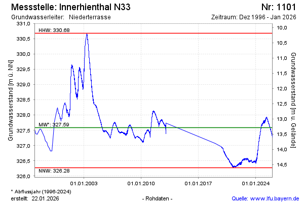
Chart of total period Innerhienthal N33
Groundwater level [m above sealevel]: 326,79
Distance to surface [m]: 14,08
Last value from 23.07.2026 08:00
Ground level [m above sealevel]: 340.87
| Date | Groundwater level [m above sealevel] |
|---|---|
| 23.07.2026 | 326.79 |
| 22.07.2026 | 326.80 |
| 21.07.2026 | 326.79 |
| 20.07.2026 | 326.80 |
| 19.07.2026 | 326.80 |
| 18.07.2026 | 326.80 |
| 17.07.2026 | 326.81 |
| 16.07.2026 | 326.81 |