
Current data InfraServ W-TBY
Groundwater level [m above sealevel]: 385.55
Distance to surface [m]: 2.85
Last value from 10.03.2026 10:00
Ground level [m above sealevel]: 388.40
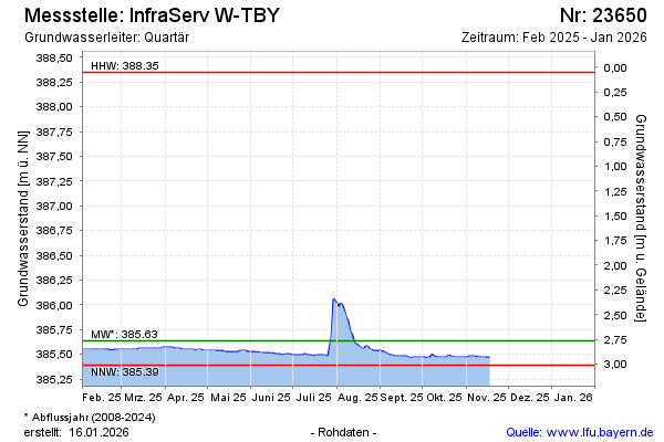
| Date | Groundwater level [m above sealevel] |
|---|---|
| 10.03.2026 | 385.55 |
| 09.03.2026 | 385.51 |
| 08.03.2026 | 385.51 |
| 07.03.2026 | 385.51 |
| 06.03.2026 | 385.52 |
| 05.03.2026 | 385.52 |
| 04.03.2026 | 385.55 |
| 03.03.2026 | 385.58 |