
- Start >
- Groundwater >
- Waterlevel of upper layer >
- Bayern >
- Illerzell, Schulzentrum N5 >
- Chart of total period

Chart of total period Illerzell, Schulzentrum N5
Groundwater levels of the total period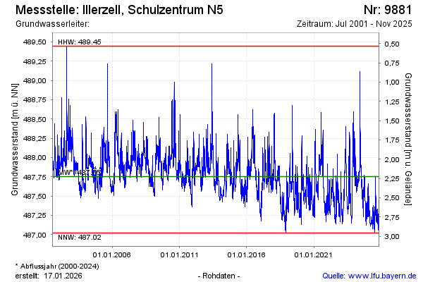
Groundwater level [m above sealevel]: 487.41
Distance to surface [m]: 2.57
Last value from 10.03.2026 14:20
Ground level [m above sealevel]: 489.98
| Date | Groundwater level [m above sealevel] |
|---|---|
| 10.03.2026 | 487.42 |
| 09.03.2026 | 487.43 |
| 08.03.2026 | 487.45 |
| 07.03.2026 | 487.48 |
| 06.03.2026 | 487.51 |
| 05.03.2026 | 487.55 |
| 04.03.2026 | 487.59 |
| 03.03.2026 | 487.64 |
© Bayerisches Landesamt für Umwelt 2026