
- Start >
- Groundwater >
- Waterlevel of upper layer >
- Bayern >
- Illerzell, Friedhof N6 >
- Current data

Current data Illerzell, Friedhof N6
Groundwater levels of the last 12 months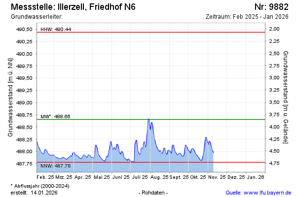
Groundwater level [m above sealevel]: 488.41
Distance to surface [m]: 4.10
Last value from 15.04.2024 09:25
Ground level [m above sealevel]: 492.51
| Date | Groundwater level [m above sealevel] |
|---|---|
| 15.04.2024 | 488.41 |
| 14.04.2024 | 488.40 |
| 13.04.2024 | 488.41 |
| 12.04.2024 | 488.45 |
| 11.04.2024 | 488.51 |
| 10.04.2024 | 488.53 |
| 09.04.2024 | 488.51 |
| 08.04.2024 | 488.48 |
© Bayerisches Landesamt für Umwelt 2024