
- Start >
- Groundwater >
- Waterlevel of upper layer >
- Bayern >
- ILLERTISSEN 2303 >
- Chart of total period

Chart of total period ILLERTISSEN 2303
Groundwater levels of the total period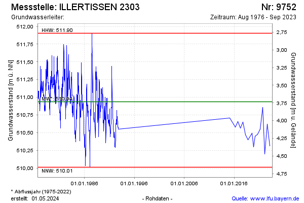
Groundwater level [m above sealevel]: 510.31
Distance to surface [m]: 4.36
Last value from 19.02.2025 14:45
Ground level [m above sealevel]: 514.67
| Date | Groundwater level [m above sealevel] |
|---|---|
| 29.08.2024 | 510.43 |
| 16.04.2024 | 510.43 |
| 06.09.2023 | 510.94 |
| 22.02.2023 | 510.31 |
| 01.09.2022 | 510.62 |
| 18.02.2022 | 510.20 |
| 06.09.2021 | 510.86 |
| 03.03.2021 | 510.55 |
© Bayerisches Landesamt für Umwelt 2026