
- Start >
- Groundwater >
- Waterlevel of upper layer >
- Bayern >
- Hygstetterhof, GWM 17-5 >
- Current data

Current data Hygstetterhof, GWM 17-5
Groundwater levels of the last 12 months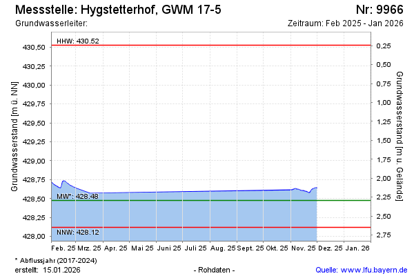
Groundwater level [m above sealevel]: 428.79
Distance to surface [m]: 1.98
Last value from 03.03.2026 08:39
Ground level [m above sealevel]: 430.77
| Date | Groundwater level [m above sealevel] |
|---|---|
| 03.03.2026 | 428.79 |
| 02.03.2026 | 428.80 |
| 01.03.2026 | 428.82 |
| 28.02.2026 | 428.84 |
| 27.02.2026 | 428.86 |
| 26.02.2026 | 428.88 |
| 25.02.2026 | 428.89 |
| 24.02.2026 | 428.86 |
© Bayerisches Landesamt für Umwelt 2026