
- Start >
- Groundwater >
- Waterlevel of upper layer >
- Bayern >
- HWS Rohrdorf GWM2 >
- Year chart of precipitation

Year chart of precipitation HWS Rohrdorf GWM2
Groundwater levels of the last 12 months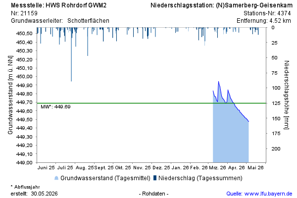
Groundwater level [m above sealevel]: 449,81
Distance to surface [m]: 3,39
Last value from 01.04.2026 13:15
Ground level [m above sealevel]: 453.20
© Bayerisches Landesamt für Umwelt 2026