
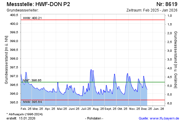
Current data HWF-DONAUWOERTH P2
Groundwater level [m above sealevel]: 396.12
Distance to surface [m]: 5.33
Last value from 13.05.2026 14:29
Ground level [m above sealevel]: 401.45
| Date | Groundwater level [m above sealevel] |
|---|---|
| 13.05.2026 | 396.16 |
| 12.05.2026 | 396.10 |
| 11.05.2026 | 396.01 |
| 10.05.2026 | 395.99 |
| 09.05.2026 | 396.00 |
| 08.05.2026 | 396.05 |
| 07.05.2026 | 396.04 |
| 06.05.2026 | 396.01 |